PHYSICAL FEATURES OF INDIA
You have already learnt earlier that India is a vast country with varied landforms. What kind of terrain do you live in? If you live in the plains, you are familiar with the vast stretches of plain land. In contrast, if you live in hilly region, the rugged terrain with mountains and valleys are common features. In fact, our country has practically all major physical features of the Earth, i.e., mountains, plains, deserts, plateaus and islands.
The land of India displays great physical variation. Geologically, the Peninsular Plateau constitutes one of the ancient landmasses on the earth's surface. It was supposed to be one of the most stable land blocks. The Himalayas and the Northern Plains are the most recent landforms. From the viewpoint of geology, Himalayan Mountains form an unstable zone. The whole mountain system of Himalaya represents a very youthful topography with high peaks, deep valleys and fast flowing rivers. The northern plains are formed of alluvial deposits. The peninsular plateau is composed of igneous and metamorphic rocks with gently rising hills and wide valleys.
MAJOR PHYSIOGRAPHIC DIVISIONS
The physical features of India can be grouped under the following physiographic divisions (Figure 2.2):
- The Himalayan Mountains
- The Northern Plains
- The Peninsular Plateau
- The Indian Desert
- The Coastal Plains
- The Islands
The Himalayan Mountains
The Himalayas, geologically young and structurally fold mountains stretch over the northern borders of India. These mountain ranges run in a west-east direction from the Indus to the Brahmaputra. The Himalayas represent the loftiest and one of the most rugged mountain barriers of the world. They form an arc, which covers a distance of about 2,400 Km. Their width varies from $400 \ \mathrm{Km}$ in Kashmir to $150 \mathrm{Km}$ in Arunachal Pradesh. The altitudinal variations are greater in the eastern half than those in the western half. The Himalaya consists of three parallel ranges in its longitudinal extent. A number of valleys lie between these ranges. The northernmost range is known as the Great or Inner Himalayas or the Himadri. It is the most continuous range consisting of the loftiest peaks with an average height of 6,000 metres. It contains all prominent Himalayan peaks.
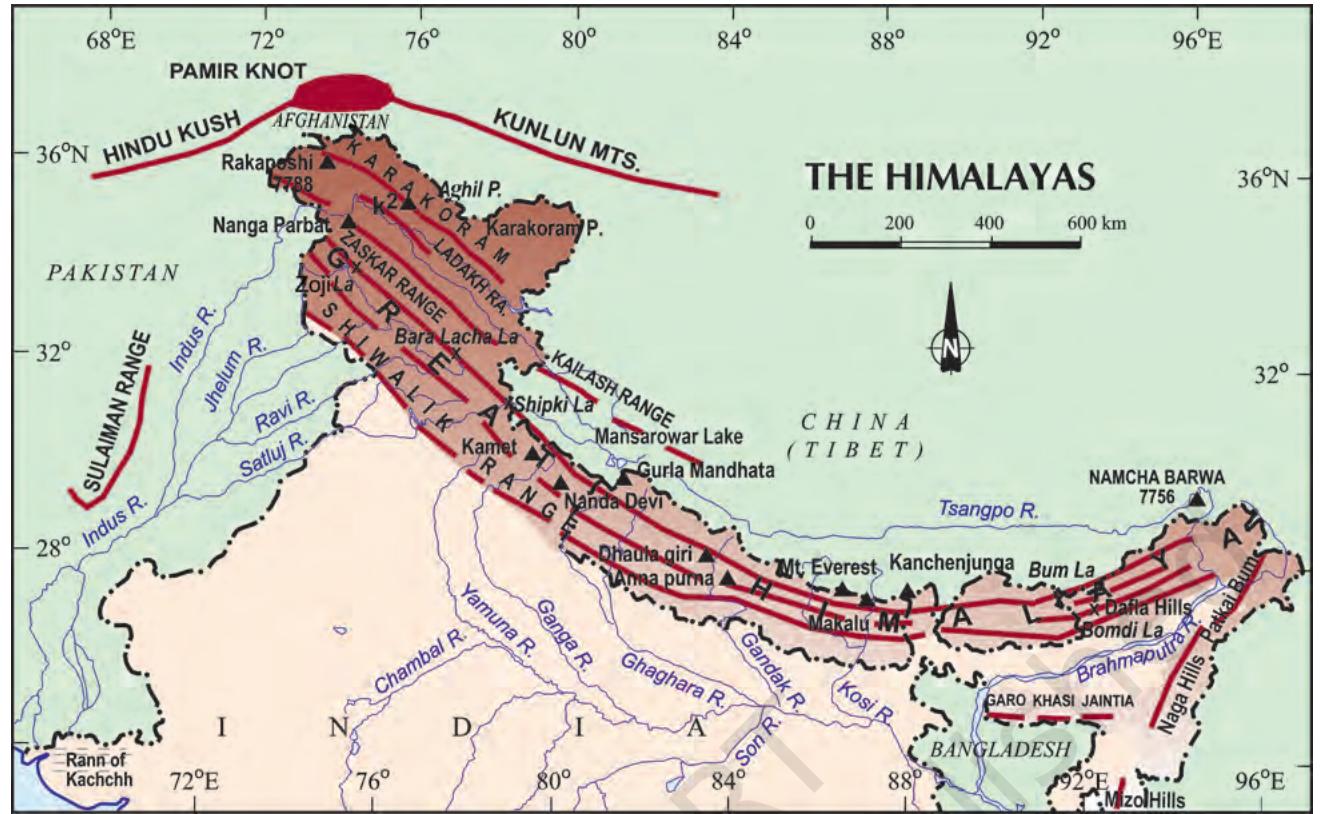 Figure 2.1 : Himalayas
Some Highest Peaks of the Himalayas
| Peak | Country | Height in metres |
|---|---|---|
| Mt. Everest | Nepal | 8848 |
| Kanchenjunga | India | 8598 |
| Makalu | Nepal | 8481 |
| Dhaulagiri | Nepal | 8172 |
| Nanga Parbat | India | 8126 |
| Annapurna | Nepal | 8078 |
| Nanda Devi | India | 7817 |
| Kamet | India | 7756 |
The folds of the Great Himalayas are asymmetrical in nature. The core of this part of Himalayas is composed of granite. It is perennially snow-bound, and a number of glaciers descend from this range.
Find out
- The names of the glaciers and passes that lie in the Great Himalayas.
- The name of the states where the highest peaks are located.
The range lying to the south of the Himadri forms the most rugged mountain system and is known as Himachal or lesser Himalaya. The ranges are mainly composed of highly compressed and altered rocks. The altitude varies between 3,700 and 4,500 metres and the average width is of $50 ~ \mathrm{Km}$. While the Pir Panjal range forms the longest and the most important range, the Dhauladhar and the Mahabharat ranges are also prominent ones. This range consists of the famous valley of Kashmir, the Kangra and Kullu Valley in Himachal Pradesh. This region is well-known for its hill stations.
Find out
- Location of Mussoorie, Nainital, Ranikhet from your atlas and also name the state where they are located.
The outermost range of the Himalayas is called the Shiwaliks. They extend over a width
of $10{-}50 \ \mathrm{Km}$ and have an altitude varying between 900 and 1100 metres. These ranges are composed of unconsolidated sediments brought down by rivers from the main Himalayan ranges located farther north. These valleys are covered with thick gravel and alluvium. The longitudinal valley lying between lesser Himalaya and the Shiwaliks are known as Duns. Dehradun, Kotli Dun and Patli Dun are some of the well-known Duns.
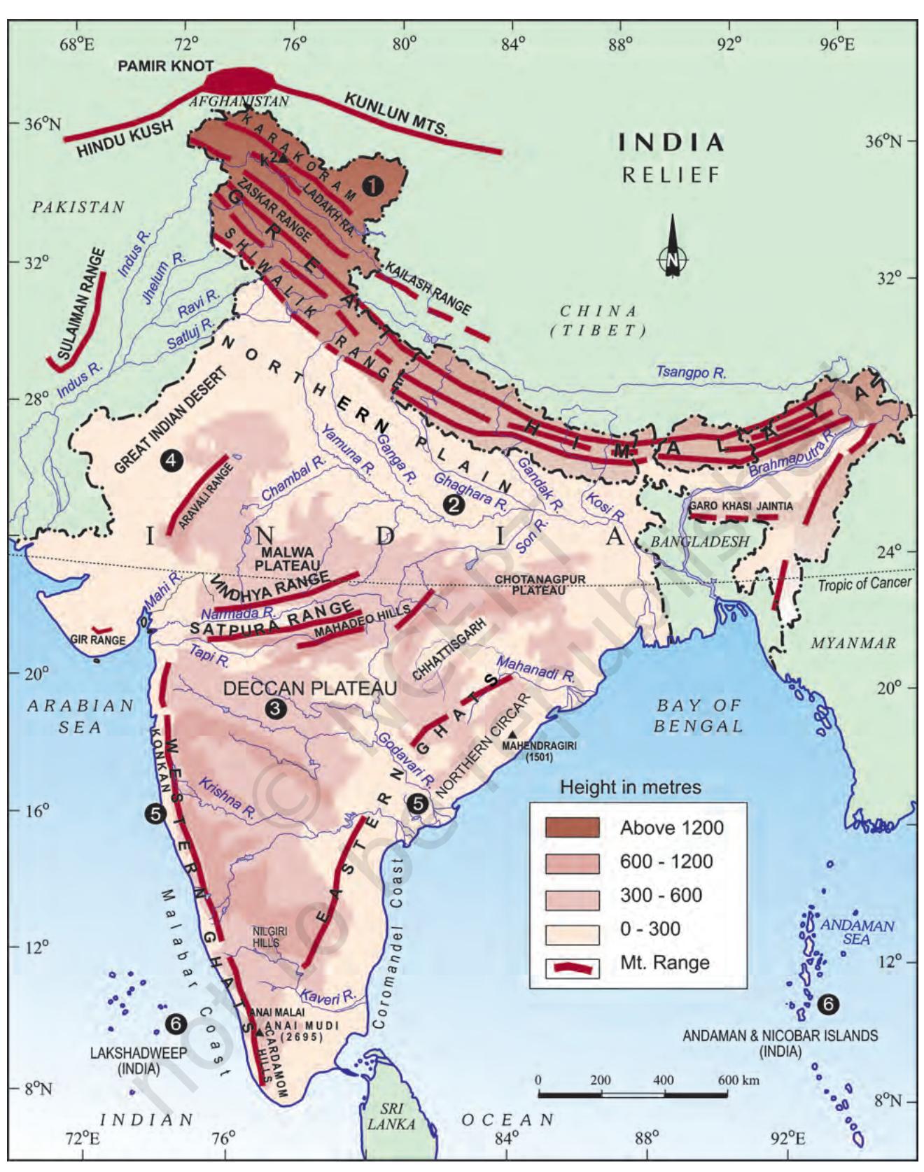 Figure 2.2 : Relief
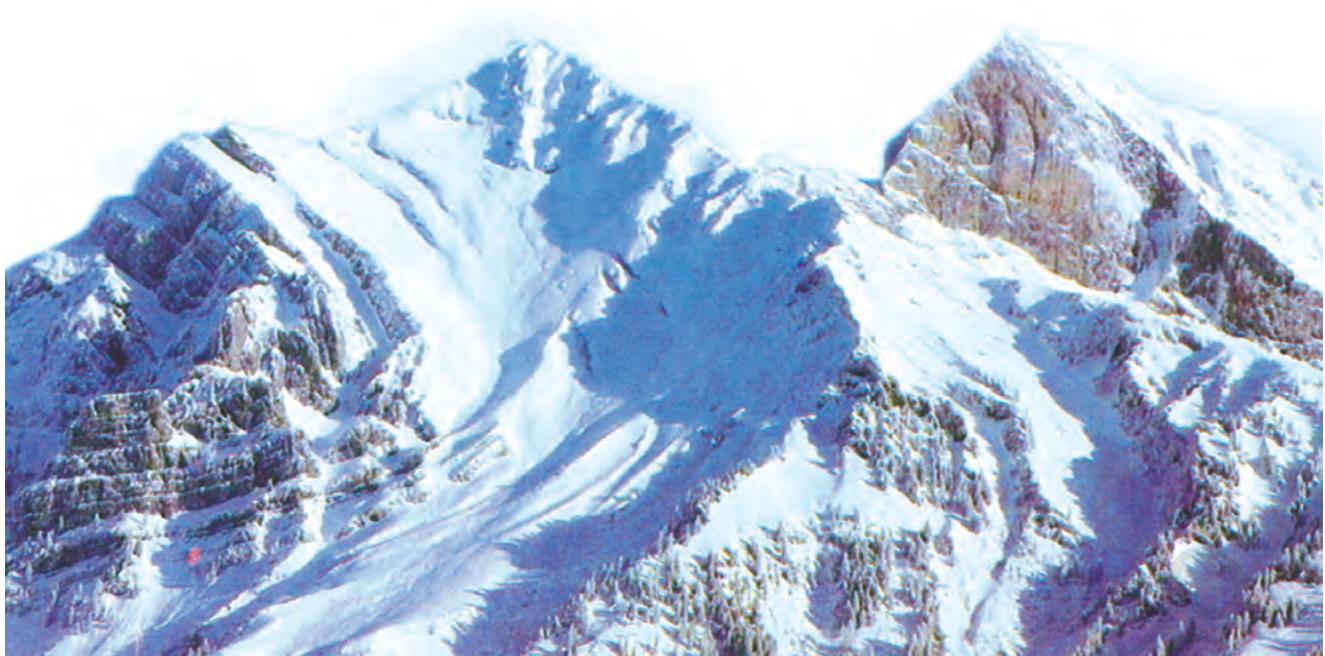 Figure 2.3 : The Himalayas
Besides the longitudinal divisions, the Himalayas have been divided on the basis of regions from west to east. These divisions have been demarcated by river valleys. For example, the part of Himalayas lying between Indus and Sutlej has been traditionally known as Punjab Himalaya but it is also known regionally as Kashmir and Himachal Himalaya from west to east respectively. The part of the Himalayas lying between Sutlej and Kali rivers is known as Kumaon Himalayas. The Kali and Teesta rivers demarcate the Nepal Himalayas and the part lying between Teesta and Dihang rivers is known as Assam Himalayas. There are regional names also in these broad categories. Find out some regional names of the Himalayas
The easternmost boundary of the Himalayas. Beyond the Dihang gorge, the Himalayas bend sharply to the south and spread along the eastern boundary of India. They are known as the Purvachal or the Eastern hills and mountains. These hills running through the north-eastern states are mostly composed of strong sandstones, which are sedimentary rocks. Covered with dense forests, they mostly run as parallel ranges and valleys. The Purvachal comprises the Patkai Hills, the Naga Hills, the Manipur Hills and the Mizo Hills.
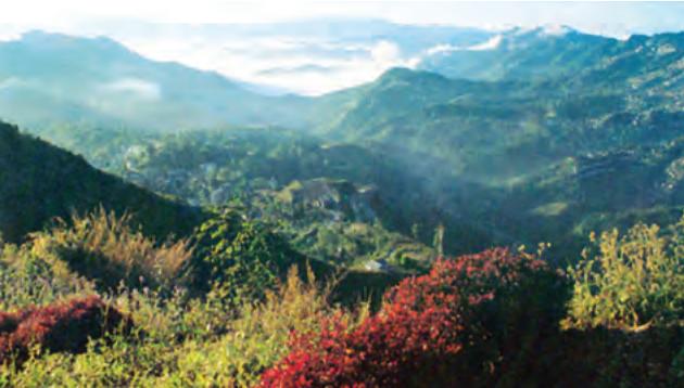 Figure 2.4 : Mizo Hills
The Northern Plain
The northern plain has been formed by the interplay of the three major river systems, namely — the Indus, the Ganga and the Brahmaputra along with their tributaries. This plain is formed of alluvial soil. The deposition of alluvium in a vast basin lying at the foothills of the Himalaya over millions of years, formed this fertile plain. It spreads over an area of 7 lakh sq. km. The plain being about $2400 ~ \mathrm{km}$ long and 240 to $320 ~ \mathrm{km}$ broad, is a densely populated physiographic division. With a rich soil cover combined with adequate water supply and favourable climate it is agriculturally a productive part of India.
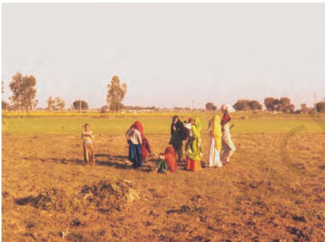 Figure 2.5 : The Northern Plains
The rivers coming from northern mountains are involved in depositional work. In the lower course, due to gentle slope, the velocity of the river decreases, which results in the formation of riverine islands.
Do You Know?
Majuli, in the Brahmaputra river, is the largest inhabited riverine island in the world.
The rivers in their lower course split into numerous channels due to the deposition of silt. These channels are known as distributaries.
The Northern Plain is broadly divided into three sections. The Western part of the Northern Plain is referred to as the Punjab Plains. Formed by the Indus and its tributaries, the larger part of this plain lies in Pakistan. The Indus and its tributaries — the Jhelum, the Chenab, the Ravi, the Beas and the Sutlej originate in the Himalaya. This section of the plain is dominated by the doabs.
Do You Know?
'Doab' is made up of two words 'do' meaning two and 'ab' meaning water. Similarly 'Punjab', is also made up two words — 'Punj' meaning five and 'ab' meaning water.
The Ganga plain extends between Ghaggar and Teesta rivers. It is spread over North India in Haryana, Delhi, U.P., Bihar, partly Jharkhand and West Bengal. In the East, particularly in Assam lies the Brahmaputra Plain.
The northern plains are generally described as flat land with no variations in its relief. It is not true. These vast plains also have diverse relief features. According to the variations in relief features, the Northern plains can be divided into four regions. The rivers, after descending from the mountains deposit pebbles in a narrow belt of about 8 to $16 \ \mathrm{km}$ in width lying parallel to the slopes of the Shiwaliks. It is known as bhabar. All the streams disappear in this bhabar belt. South of this belt, the streams and rivers re-emerge and create a wet, swampy and marshy region known as terai. This was a thickly forested region full of wildlife. The forests have been cleared to create agricultural land and to settle migrants from Pakistan after partition. Locate Dudhwa National Park in this region.
The largest part of the northern plain is formed of older alluvium. It lies above the floodplains of the rivers and presents a terracelike feature. This part is known as bhangar. The soil in this region contains calcareous deposits, locally known as kankar. The
newer, younger deposits of the floodplains are called khadar. They are renewed almost every year and so are fertile, thus, ideal for intensive agriculture.
The Peninsular Plateau
The Peninsular Plateau is a tableland composed of the old crystalline, igneous and metamorphic rocks. It was formed due to the breaking and drifting of the Gondwanaland and thus, making it a part of the oldest landmass. The plateau has broad and shallow valleys and rounded hills. This plateau consists of two broad divisions, namely, the Central Highlands and the Deccan Plateau. The part of the Peninsular Plateau lying to the north of the Narmada River, covering a major area of the Malwa Plateau, is known as